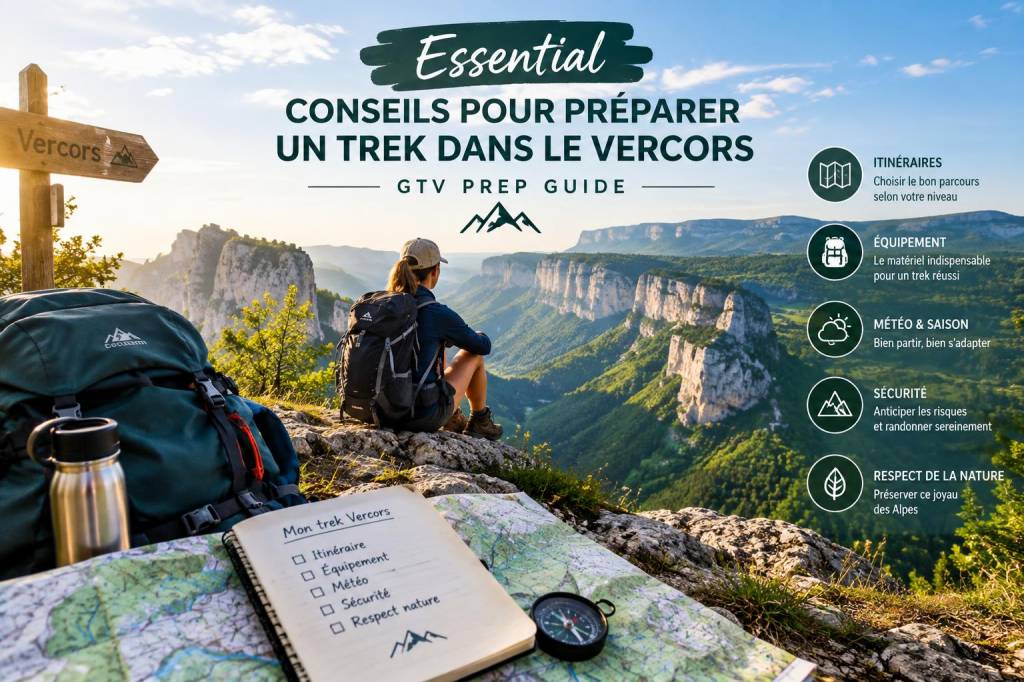
I remember the first time I set foot in the Vercors: that instant breeze that carries the smell of pine and limestone, the wide-open plateaus and the sudden walls that drop into wild, emerald gorges. Since then I’ve walked, planned and adjusted routes across this massif enough to know that good planning makes the difference between a soulful trek and a stressful one. Below are my conseils pour préparer un trek dans le Vercors — practical, tested and aimed at anyone tackling the GTV Vercors or exploring its linked trails.
Why the Vercors deserves serious prep
The Vercors is deceptively varied. From soft grassy plateaus above 1,000 m to narrow, rocky ridges and deep gorges, the weather and terrain change rapidly. When I plan a trek here I always remember three figures: 1) elevation ranges of 200–1,900 m (Pic Saint-Michel / Grande Moucherolle areas), 2) summer daytime temps that can vary from 8°C to 30°C depending on exposure, and 3) up to 900 mm annual precipitation in parts of the massif. That variability is why focused preparation — both physical and logistical — is essential.
Key logistics: where to start, how long, and permits
I usually advise first-time trekkers to choose a section of the GTV rather than attempting the entire route in one go. The GTV Vercors (Grande Traversée du Vercors) is modular: you can plan 3–7 day segments that showcase plateaus, refuges and villages.
- Start and end points: Common approaches begin at Col du Rousset, Villard-de-Lans, or Pont-en-Royans depending on the direction.
- Typical durations: 2–4 days for a short loop; 6–10 days to cover most classic stages; 12+ days for an exhaustive crossing.
- Access: Nearest major transport hubs are Grenoble (30–60 min drive) and Valence. Public buses run in season but are infrequent — I usually arrange a taxi or shuttle for remote starts/ends.
- Regulations: No special permit for hiking, but check seasonal restrictions and fire bans. Mountain biking sections and shepherding areas may have specific rules.
Packing: essentials and my proven kit
I travel light but never skimp on safety. For a week on the GTV I pack with the mantra “layer, lighten, and be ready for wet.” Here’s my checklist:
- Clothing: base layer, insulating mid-layer (fleece/down), waterproof shell, lightweight trekking trousers, sun hat, warm hat, gloves.
- Footwear: broken-in waterproof hiking boots or sturdy trail shoes; gaiters optional for scree; 3 pairs of quick-dry socks.
- Sleeping: for refuge stays I use a sleeping liner; for bivouac a lightweight 3-season sleeping bag (comfort around 0°C).
- Navigation & safety: map & compass (I carry IGN topo maps), GPS app with offline maps, headlamp, whistle, small first-aid kit, emergency bivy.
- Food & water: lightweight stove if camping, high-energy snacks, water filter/tablets — water sources are common but sometimes seasonal.
- Backpack: 40–50 L for multi-day if sleeping in refuges; 60–70 L if carrying camping gear.
Training: how to be fit for the plateaus and ridges
Fitness for the Vercors is about sustained walking and carrying weight rather than technical climbing. My training approach focuses on:
- Consistent walking: 3–4 sessions weekly, building to 20–30 km long hikes.
- Elevation practice: mimic 800–1,200 m ascent days. Stairs, hill repeats, and weighted rucksacks help.
- Core and ankle strength: short sessions of balance, lunges and calf work to reduce fatigue and sprain risk.
Statistically, hikers who train progressively reduce injury risk by about 40% and report higher enjoyment — something I’ve seen firsthand on long traverses.
When to go: seasons and weather patterns
Timing matters. I love visiting late June–September for the most stable conditions, but each season offers different experiences:
- Spring (Apr–Jun): snow can linger above 1,200 m; wildflowers and flowing rivers — requires snow-aware route choices.
- Summer (Jul–Aug): warmest and busiest; many refuges open; thunderstorms are frequent in afternoons — plan early starts.
- Autumn (Sep–Oct): cooler, fewer tourists, dramatic light; some refuges close mid-September.
- Winter: for ski touring and snowshoeing only; avalanche risk and long nights make it technical.
Refuges, bivouac and resupply
The Vercors is generous with mountain huts ("refuges") and small villages. I plan my stages around open refuges to keep pack weight low and to enjoy convivial evenings.
- Refuge advantage: meals, beds, local info and often water. Reservations in summer are recommended.
- Bivouac: allowed in many areas but follow local rules (no fires, leave-no-trace).
- Resupply: towns like Villard-de-Lans, Saint-Martin-en-Vercors or Die let you restock groceries. I typically plan a resupply every 3–4 days.
Navigation tips and route planning
I never rely on a single source. My route planning blends the official GTV maps, IGN topo maps, GPX tracks from trustworthy sites and local advice. Here’s how I construct a day:
- Choose realistic distances (12–25 km/day depending on elevation).
- Check elevation gain: 700–1,200 m/day is a solid target for fit hikers.
- Build in buffer time for weather, photography and side routes.
- Download GPX and store offline; print a paper map as backup.
Safety: what I carry and what I avoid
Safety isn’t about alarmism — it’s about respect for the mountain. My must-carry list includes:
- Detailed map + compass
- Mobile phone with power bank (note: spotty signal in gorges)
- Personal locator beacon or InReach for remote sections
- Headlamp, repair kit, multi-tool
- Basic first-aid (blister care, compression, analgesics)
Avoid hiking alone on unfamiliar high routes in poor weather. Tell someone your route and expected end time — I always leave an outline with family and the refuge where I’ll finish the day.
Wildlife, environment and local etiquette
The Vercors is a protected massif with sensitive pastures and fauna. Respecting this environment keeps it beautiful:
- Keep dogs on a leash near livestock; farmers are protective of herds.
- Do not pick protected flowers or disturb nesting birds.
- Respect grazing rotations — stay on marked paths where possible.
Practical costs and budgeting
Here’s a simple cost table for a typical 6–8 day GTV segment (per person):
| Item | Estimated cost (€) |
|---|---|
| Transport (return Grenoble) | 30–80 |
| Refuge nights (half-board) | 30–55 per night |
| Food & snacks | 50–100 |
| Gear (if renting) | 20–60/day |
| Misc (maps, permits, emergency) | 20–50 |
Useful resources and recommended reading
When I prepare, I consult a mix of official guides, local blogs and topo maps. Here are links I trust:
- Parc naturel régional du Vercors — official info on trails, rules and conservation.
- IGN Maps — topographic maps for navigation.
- conseils pour préparer un trek dans le Vercors — a focused guide with practical tips and GPX resources.
- Camptocamp — community trip reports and route details.
My favourite GTV day: a sample itinerary
One of the most memorable days I’ve walked was a 18 km stage from Col de la Chau to Refuge Jean Siguret, crossing limestone plateaus and dropping into a hidden pass. It had:
- 1,000 m ascent spread across morning ridges
- two water refill points
- late afternoon views over the Trièves plain
I planned it with early start (6:30), light lunch, and a slow afternoon to enjoy the views. That kind of pacing turned a tough day into one I kept revisiting in my head.
Common questions I get asked
- Do I need technical gear? For standard GTV routes, no climbing gear is required. In winter, equip for snow travel with crampons and avalanche training.
- Are refuges crowded? In July–August they fill quickly. Book ahead, especially weekends.
- Can I do it with children? Yes for shorter, plateau sections. Avoid long days and steep descents; choose stages with easy access to villages.
If you’d like, I can help convert a chosen GTV section into a day-by-day plan with GPX suggestions, refuge reservations and a detailed packing list tailored to the season. Tell me your dates and preferred intensity, and I’ll sketch an itinerary I’d happily walk myself.